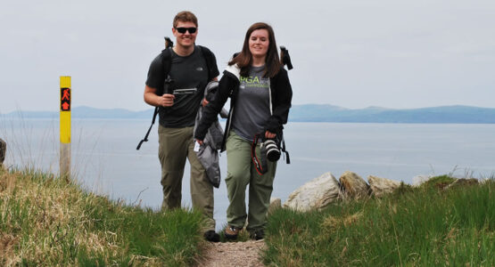
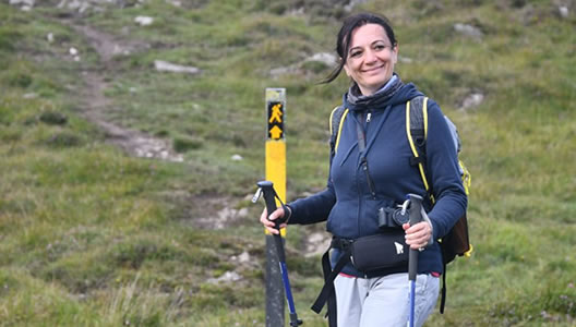
The Beara Way self-guided walking trail is 196 km / 122.5 miles long and is shared between county Cork and Kerry on the most south-westerly tip of Ireland. The Beara Peninsula is part of the Wild Atlantic Way. It is a rugged peninsula that reaches out into the wild Atlantic Ocean and Bantry Bay is breathtakingly beautiful, picturesque and mystical.
The trail takes you along small country roads, passing numerous monuments and sights of great archaeological interest, through many small towns and villages and through some of the most scenic parts of Ireland.
Warmed by the Gulf Stream, the climate here is pleasant throughout the year supporting a unique combination of highly colourful flora and fauna. During your 9-day walking tour, you will also visit the enchanted islands of Beara and Dursey.
Prices / Dates
Price: €1049 per person sharing
Single Supplement: +€535
Solo Traveller Supplement: +€110
Tour Dates: 1st April to 15th October
Tour Grade: Easy to Moderate
Accommodation: Guesthouse & B&Bs
Included / Excluded
- 8 nights bed & breakfast
- All accommodation is pre-booked in approved and carefully selected family-run guesthouses with all rooms en-suite.
- Maps and all route notes
- GPS Tracks
- Details on restaurants and places of interest to visit along the way.
- Luggage transfers daily while you walk.
- All information on trains or buses needed to get to your first accommodation in Castletownbere and back at the end of the tour from Kenmare.
- 24-7 Emergency Telephone support
- Public transport to the beginning of the tour and back at the end
- Packed Lunches
- Evening Meals
- Drings and Snacks
- Personal Equipment
Arrive at Cork or Dublin Airport and take public transport to Glengariff. It may also be possible to arrive at Shannon or Kerry Airport, depending on your arrival time. Please check with Footfalls before you book your flights. We will supply you with all the onward travel details needed to get to your first accommodation.
Overnight Glengariff
There is no accommodation available in Adrigole, so we offer a Complimentary taxi transfer to the start of your walk.
Today the Beara Way offers you sweeping views across Bantry Bay to Beara Island on one side and Hungry Hill and the Slieve Miskish Mountains on the other. You will walk along a trail that flanks the southern slopes of Hungry Hill (the highest mountain on the peninsula), passing Park Lough, and through Comnagapple Glen to end your day in Castletownbere.
Distance: 20 km / 12.5 miles, Ascent: 750m / 2460ft, Approximate walking time: 6 / 7 hours
Overnight Castletownbere
Today you will walk from Castletownbere to Allihies through the Slieve Miskish Mountains. Some of today’s route passes through conifer forests, about the only alternative on poor bogland to turf cutting or sheep farming. The Beara Way walking trail crosses open hill terrain and is under the peak of Knockgour at 481 m. You will pass a ringfort (an ancient farm enclosure), which would have served as a home for people and animals.
Allihies is a colourful coastal village, surrounded by the remains of copper mines. Crushed stones from the mines formed the beach here.
Distance: 15.7 km / 10 miles, Ascent: 647 m / 1942 ft, Approximate walking time: 4 / 5 hours
Overnight Allihies
You will be transported today from Allihies to Dursey Sound, where you will take a cable car across to the island on the only cable car which crosses seawater anywhere in Ireland. The journey is only 200m, and the island is only 6.5 km/4.6 miles long and 1.5km/1 mile wide with a population of only six people. Dursey Island has no shops, pubs or restaurants and is famous for its great variety of bird species and is a birdwatchers’ heaven. The island offers a barren and charming beauty with a rugged coastline, cliffs and a patchwork of fields divided by dry stone walls and ditches. Dursey was awarded one of the top 10 walks in Ireland for 2010.
Distance: 14 km / 8.7 miles, Ascent: 240 m / 720 ft, Approximate walking time: 4 / 5 hours
Overnight Allihies
From Dursey Sound, the trail takes you along the coastline to the small fishing port of Garnish Point. From here, the trail follows a small country road that takes you along the slopes of Canalmore and Follshauncrone Mountain.
Along the way, you will have stunning views across Garnish and Ballydonegan Bay and the Atlantic Ocean to Cod’s Head. Once again, this is a great area for bird watching or photography. The final section of the trail takes you along by Ballydonegan Strand and back into the village of Allihies.
Distance: 17 km / 10.6 miles, Ascent: 270 m / 810 ft, Approximate walking time: 5 / 6 hours
Overnight Allihies
This may be a short walk day, but the views along the way are incredibly beautiful. You will leave the village and walk through what remains of an old copper mine which was once the largest producer of copper in Europe. The trail follows an old disused road that offers you views across Clough Bay, the Kenmare River and beyond to the Kerry Coastline.
Distance: 12 km / 7.5 miles, Ascent: 490 m / 1500 ft, Approximate walking time: 3 / 4 hours
Overnight Eyeries
After leaving Eyeries, the trail takes you down to Eyeries Point to follow a beautiful coastal path by Coulagh Bay to reach Ballycrovane Harbour. Here is the site of a magnificent 4.7 m/14 ft prehistoric standing stone which still has an inscription in ancient Ogham writing.
From here the trail turns inland to pass a charming lake called Lough Fadda (Long Lake) and continues on to follow a small ridge that offers a new panorama of the Kenmare River. The trail takes you through the quaint village of Ardgroom, walking parallel to the Ring of Beara road to cross the border in County Kerry and the village of Lauragh.
Distance: 27.2 km / 17 miles, Ascent: 950 m / 2850 ft, Approximate walking time: 8 / 9 hours
Overnight Lauragh
You have the option today to be transported to Drombohilly Lower, which shortens your walk to 19 km/11.8 miles. The trail takes you out of Lauragh on a small country road to ascent steadily, passing Knockatee and Drombohilly Mountains and the picturesque and lonesome Gowlaun Lough. Skirting around the base of Knockagarrane Mountain, you will join a small track that leads you to your final ascent onto the saddle of Derrysallagh. From here, you start your descent into the charming and colourful town of Kenmare.
(You could extend your walking tour by another day and walk the old Kenmare Road into the town of Killarney, through part of Killarney’s National Park and visit Muckross House and Gardens).
Option 1 - Distance: 25 km / 15.5 miles, Ascent: 987 m / 2961 ft, Approximate walking time: 7 / 8 hours
Option 2 - Distance: 19 km / 11.8 miles, Ascent: 987 m / 2961 ft, Approximate walking time: 5 / 6 hours
Overnight Kenmare
After breakfast, you will depart for home.


