The Pembrokeshire Coastal Path was officially opened in 1970 and honoured to be the first National Way Marked Trail in Wales. The trail follows the coastline from Amroth in the south to St Dogmales in the north covering a distance of just under 300 km or 186 miles.
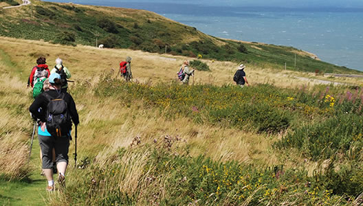
You will experience sandy bays, limestone cliffs, coastal flowers and fauna as well as evidence of human activity from Neolithic times to the present and some of the most breathtaking coastal scenery in Wales.
For this 8-Day self-guided walking tour of the Pembrokeshire Coastal Path, the trail takes you from Amorth to Whitesands, covering just over 193.4 km / 120.9 miles.
Prices / Dates
Price: £1279 per person sharing
Single Supplement: +£550
Solo Traveller Supplement: +£200
Tour Dates: 1 April to 15 October
Tour Grade: Moderate
Accommodation: Guesthouse or B&B
Included / Excluded
- 11 nights bed & breakfast
- All accommodation is pre-booked in approved family-run guesthouses with all rooms en-suite.
- Maps and all route notes
- GPX Tracking Files for each day
- Details on restaurants and places of interest to visit along the way.
- Luggage transfers daily while you walk with a small day pack.
- All information on trains or buses needed to get to your first accommodation and back at the end of the tour.
- 24-7 Emergency Telephone support
- Public transport to the beginning of the tour and back at the end
- Packed Lunches
- Evening Meals
- Drinks & Snacks
- Personal Equipment
You will take public transport to the start of your adventure in Amroth, and we will provide you with all the details you require to get to your first accommodation. Or, you can check out and plan your own travel as part of the buildup to your adventure on the Pembrokeshire Coastal Path.
The best airports to arrive into are, Cardiff being the closest, but you can also fly to Bristol - Birmingham or Manchester and take a train to your first destination.
Remember, we will do all this planning for you at no extra charge, all we need is your arrival and departure destinations.
The first section of the trail takes you through a short section of woodland, one of the very few sections of woodland that you are going to encounter on any day’s walk along the Pembrokeshire Coast Path. You will have great views across to Caldey Island, follow the promenade through Saundersfoot, a popular spot for windsurfing. Visit the ruins of the 13th Century Tenby Castle and walk along the golden sandy beach of Lydstep Haven. Overnight stay is in Lydstep.
Distance: 21. km / 13.2 miles, Ascent: 680 m / 2040 ft.
Approximate walking time: 7/8 hrs.
From Lydstep the trail takes you up over the Skrinkle Haven Sea Cliffs where you will be rewarded with some stunning views back over yesterday’s trail and ahead to Manorbier Castle and beyond to the East and West Moor Cliffs.
You will walk through the sand dunes of Freshwater East and a chance to stop for lunch in the National Trust Boathouse Tearoom. Your day finishes in the small village of Bosherston. Overnight stay in Bosherston.
Distance: 20 km / 12.5 miles, Ascent: 695 m / 2085 ft
Approximate walking time: 7/8 hrs.
Today the trail passes the Castlemartin military range and on certain days of the year, they will be on active training duties, if this is the case you will have to make and extra 2 km detour. Full details of training days and detour will be included in your tour package.
For the first section of the trail, we have decided to take you away from the coast to follow the Wales Coastal Path through farmland for approximately 5 km to meet to Pembrokeshire Coastal Path at Merrion and continue as normal. The trail descends to meet the coast at Freshwater West and then climbs steadily to take you up onto the sea cliffs at Trewent Point. A beautiful 5 km section now awaits you and offers some of the finest views of the day. Your day finishes in the charming village of Angle situated in a sheltered valley of East Angle Bay on the Milford Haven Waterway. A short transfer to your overnight in Pembroke.
Distance: 22 km / 13.75 miles, Ascent: 675 m / 2025 ft
Approximate walking time: 7/8 hrs
An easier walking day today that leads you out from Angle along the coast by Angel Bay. If you are a wildlife enthusiast or a nature lover, this section will not disappoint.
The trail continues around the headland by some of Pembrokeshire industry which remains generally hidden from view. As you approach Pembroke, views of the impressive Pembroke Castle will come into sight. The castle is definitely worth a visit, be aware. There is an entry fee. Overnight stay is in Pembroke.
Distance: 19.2 km / 12 miles, Ascent: 365 m / 1095 ft
Approximate walking time: 6/7 hrs.
From Pembroke, the path crosses the Pembroke River at Mill Bridge giving extensive views of the castle and Pembroke River. Through a riverside woodland where you will see the remains of old limestone quarries which provided the stone for the castle walls. You will skirt the villages of Neyland and Llanstadwell and out into the open countryside through fields at Hazel and Beach. You will have great views of the waterway back towards Pembroke and the Cleddau Bridge. Overnight stay is in Milford Haven
Distance: 20 km / 12.5 miles, Ascent: 430 m / 1290 ft
Approximate walking time: 7/8 hrs
You have two river crossings today with the aid of a low bridge, you will have to cross at low tide, or you will have to make detours. (Tidal times will be included in your tour notes.)
The trail takes you out of Milford Haven on a beautiful coastal path that overlooks Milford Haven and into the beautiful Cobh of Sandy Haven. Here you have to make a crossing over a low bridge and once over the trail. leads you around by Little and Great Castle Head, Watch House Point and into the sandy beach of Aber y Gann. This is a great area for birdwatching. Once over the causeway follow the trail into Dale. Overnight stay is in Dale or Marloes.
Distance: 15.2 km / 9.5 miles, Ascent: 290 m / 870 ft
Approximate walking time: 5 /6 hrs
This section of the Pembrokeshire Coastal Path takes you out past Castlebeach and Watwick Bay, two secluded golden alcoves carved out of the landscape. This was the landing point of Henry VII in 1485 as he made his way to the Battle of Bosworth.
The trail continues passing the mouth of Milford Haven, rounding St Ann’s Head before turning north to take you along by Frenchman’s and Welshman’s Bay.
You will pass a disused airfield at Dale, you round Hooper’s Point to glorious views of Marloes Sands stretching out before you.
Distance: 18 km / 11.25 miles, Ascent: 355 m / 1065 ft
Approximate walking time: 7/8 hrs
From Melroes the Pembrokeshire Coastal Path leads you to Martins Haven where you will have some lovely views across to Skomer Island. The island is best known for its large breeding seabird population, including Atlantic puffins, Manx shearwaters, razorbills, guillemots, great cormorants, and thousands of other seabirds on the water and soaring above the cliffs. Why not add in a rest day in Marloes and take a 15-minute boat trip to enjoy one of the most incredible wildlife experiences in Britain. Please note, there are no sailings on Mondays, and sailings are weather dependant. Cost is not included in tour price.
The trail continues around the cliff tops that overlook Musselwick Sands, along by St Bride’s Bay where you will be overlooking Warey and Mill Haven. Ahead you will have beautiful views of to St David’s Head and Ramsey Island to finish your day in Broad Haven. Overnight stay is in Broad Haven
Distance: 18 km / 11.25 miles, Ascent:560 m / 1680 ft
Approximate walking time: 7/8 hrs
The trail takes you along by the golden sandy beach of Broad Haven and out over the clifftops that overlooks St Brigit’s Bay. You will pass the magical, secluded bays of Druidston Haven and Nolton Haven. After Nolton Haven you have a short steep climb back onto the clifftop trail and on to Maidenhall Point and back down to the village of Newgale. The village is renowned for having one of the best surfing beaches in Pembrokeshire that stretches for just over 3 km / 2 miles, the perfect spot to stop for lunch and just watch the world go by.
Your final section for the day takes you back onto the clifftops once more, along by Porth Mynawyd, Aber West and finally into the hamlet of Solva. Overnight stay in Solva.
Distance: 20 km / 12 miles, Ascent: 925 m / 2775 ft
Approximate walking time: 7/9 hrs
The Pembrokeshire coastal path takes you out of Solva and back onto the cliff path where you will be rewarded with some glorious views back over Solva, out across St. Brigit’s Bay and ahead to Ramsey and Skomer Islands. You will pass Caer Bwdy and Caerfai Bays. The purple sandstone used for the building of St. David’s Cathedral was quarried from these two bays. A little further on is St. Non’s Bay, named after St David’s mother.
The trail rounds the head at Penmaen Melyn where the path turns north to follow the eastern shore of Ramsey Sound to finish your day at Whitesand Bay. Overnight Stay in St. Davids.
Distance: 22 km / 13.75 miles, Ascent: 720 m / 2160 ft
Approximate walking time: 7/9 hrs
Depart by public transport for your onward journey.